
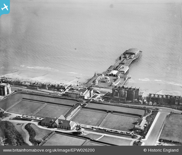
EPW026200 ENGLAND (1929). The Pier, White Rock Pavilion and bowling greens, Hastings, 1929
© Copyright OpenStreetMap contributors and licensed by the OpenStreetMap Foundation. 2024. Cartography is licensed as CC BY-SA.
Nearby Images (24)
EPW026200

EAW022975

EPW035339

EPW039390

EPW039388

EPW035334

EPW000060B

EPW026209

EPW044648

EPW026188

EAW002408

EPW026191

EPW035342

EPW035346

EAW002409

EPW042839

EPW042840

EAW002407

EPW000754

EPW035345

EAW030089

EAW006618

EAW006619

EPW000115

Details
| Title | [EPW026200] The Pier, White Rock Pavilion and bowling greens, Hastings, 1929 |
| Reference | EPW026200 |
| Date | 24-April-1929 |
| Link | |
| Place name | HASTINGS |
| Parish | |
| District | |
| Country | ENGLAND |
| Easting / Northing | 581209, 109067 |
| Longitude / Latitude | 0.57469155340494, 50.852135033481 |
| National Grid Reference | TQ812091 |
Pins
Be the first to add a comment to this image!


