
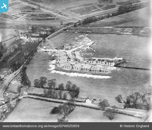
EPW025859 ENGLAND (1929). Housing along Belvue Road and Sandringham Road under construction, Northolt, 1929
© Copyright OpenStreetMap contributors and licensed by the OpenStreetMap Foundation. 2024. Cartography is licensed as CC BY-SA.
Nearby Images (12)
EPW025859

EPW025854

EPW025852

EPW025857

EPW025856

EPW025858

EPW025855

EPW025860

EPW025853

EPW025851

EPW025861

EPW035056

Details
| Title | [EPW025859] Housing along Belvue Road and Sandringham Road under construction, Northolt, 1929 |
| Reference | EPW025859 |
| Date | March-1929 |
| Link | |
| Place name | NORTHOLT |
| Parish | |
| District | |
| Country | ENGLAND |
| Easting / Northing | 513269, 184305 |
| Longitude / Latitude | -0.36633764017181, 51.545778610694 |
| National Grid Reference | TQ133843 |
Pins
 Happyisseb |
Friday 19th of October 2012 05:21:30 PM | |
 Class31 |
Friday 28th of September 2012 06:25:56 PM | |
Class31 |
Tuesday 18th of September 2012 04:15:29 PM | |
Class31 |
Tuesday 18th of September 2012 04:14:43 PM | |
Class31 |
Tuesday 18th of September 2012 04:13:44 PM | |
Class31 |
Tuesday 18th of September 2012 04:13:08 PM |


