
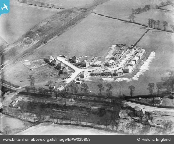
EPW025853 ENGLAND (1929). Housing along Belvue Road and Sandringham Road under construction, Northolt, 1929
© Copyright OpenStreetMap contributors and licensed by the OpenStreetMap Foundation. 2024. Cartography is licensed as CC BY-SA.
Nearby Images (13)
EPW025853

EPW025855

EPW025858

EPW025860

EPW025861

EPW025852

EPW025851

EPW025859

EPW025854

EPW025856

EPW025857

EPW040792

EPW035056

Details
| Title | [EPW025853] Housing along Belvue Road and Sandringham Road under construction, Northolt, 1929 |
| Reference | EPW025853 |
| Date | March-1929 |
| Link | |
| Place name | NORTHOLT |
| Parish | |
| District | |
| Country | ENGLAND |
| Easting / Northing | 513266, 184349 |
| Longitude / Latitude | -0.36636672257008, 51.546174719193 |
| National Grid Reference | TQ133843 |
Pins
 j miller |
Monday 11th of November 2013 12:04:56 PM | |
j miller |
Monday 11th of November 2013 12:02:03 PM | |
 Class31 |
Friday 28th of September 2012 06:30:05 PM | |
Class31 |
Friday 28th of September 2012 06:17:32 PM | |
Paul |
Wednesday 19th of September 2012 08:30:47 PM | |
Class31 |
Tuesday 18th of September 2012 04:17:43 PM |


