
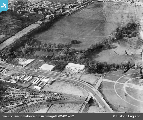
EPW025232 ENGLAND (1928). Gunnersbury Park and the Great West Road, Brentford, 1928
© Copyright OpenStreetMap contributors and licensed by the OpenStreetMap Foundation. 2024. Cartography is licensed as CC BY-SA.
Nearby Images (5)
EPW025232

EPW037583

EAW052944

EAW052942

EAW052939

Details
| Title | [EPW025232] Gunnersbury Park and the Great West Road, Brentford, 1928 |
| Reference | EPW025232 |
| Date | 25-October-1928 |
| Link | |
| Place name | BRENTFORD |
| Parish | |
| District | |
| Country | ENGLAND |
| Easting / Northing | 518775, 178602 |
| Longitude / Latitude | -0.28888527813413, 51.493385200783 |
| National Grid Reference | TQ188786 |
Pins
 IJD |
Sunday 5th of January 2020 07:11:05 PM | |
Mark Amies |
Wednesday 9th of January 2019 04:10:58 PM | |
Mark Amies |
Wednesday 9th of January 2019 04:09:51 PM |


