
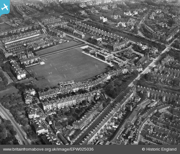
EPW025036 ENGLAND (1928). The Royal Grammar School, Newcastle upon Tyne, 1928
© Copyright OpenStreetMap contributors and licensed by the OpenStreetMap Foundation. 2024. Cartography is licensed as CC BY-SA.
Nearby Images (7)
EPW025036

EPW025033

EPW019807

EPW026668

EPW026661

EPW026663

EPW026658

Details
| Title | [EPW025036] The Royal Grammar School, Newcastle upon Tyne, 1928 |
| Reference | EPW025036 |
| Date | 12-October-1928 |
| Link | |
| Place name | NEWCASTLE UPON TYNE |
| Parish | |
| District | |
| Country | ENGLAND |
| Easting / Northing | 425133, 565405 |
| Longitude / Latitude | -1.6072352216573, 54.982536329637 |
| National Grid Reference | NZ251654 |
Pins
Be the first to add a comment to this image!


