
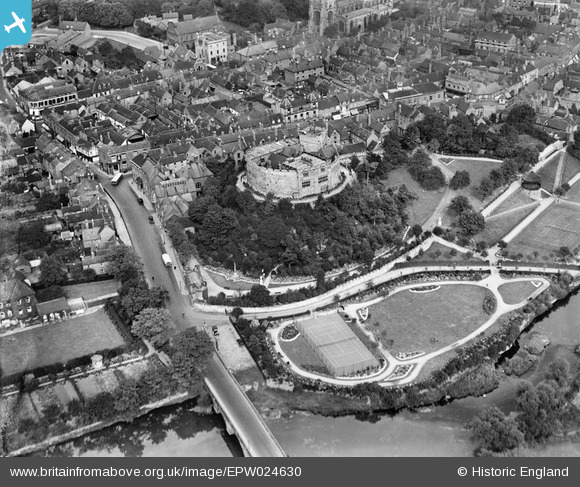
EPW024630 ENGLAND (1928). Tamworth Castle and the town centre, Tamworth, 1928
© Copyright OpenStreetMap contributors and licensed by the OpenStreetMap Foundation. 2024. Cartography is licensed as CC BY-SA.
Nearby Images (18)
EPW024630

EAW007508

EPW019731

EPW019732

EAW007511

EAW007509

EAW003617

EAW007512

EAW007514

EAW007510

EAW007513

EAW003618

EAW003616

EPW024634

EPW019733

EPW024637

EPW019734

EPW024636

Details
| Title | [EPW024630] Tamworth Castle and the town centre, Tamworth, 1928 |
| Reference | EPW024630 |
| Date | September-1928 |
| Link | |
| Place name | TAMWORTH |
| Parish | |
| District | |
| Country | ENGLAND |
| Easting / Northing | 420599, 303894 |
| Longitude / Latitude | -1.6956093172821, 52.632056489206 |
| National Grid Reference | SK206039 |
Pins
 Chris Gibson |
Saturday 20th of October 2012 01:02:28 PM | |
Chris Gibson |
Saturday 20th of October 2012 12:57:58 PM | |
Chris Gibson |
Saturday 20th of October 2012 12:56:48 PM |
User Comment Contributions
 Tamworth Castle |
Robert - Cumbria |
Wednesday 27th of June 2012 12:01:01 AM |


