
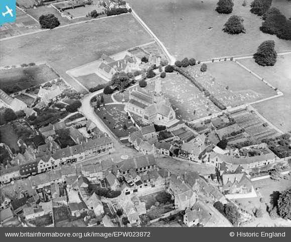
EPW023872 ENGLAND (1928). Holy Trinity Church and environs, Minchinhampton, 1928
© Copyright OpenStreetMap contributors and licensed by the OpenStreetMap Foundation. 2024. Cartography is licensed as CC BY-SA.
Nearby Images (3)
EPW023872

EPW023871

EPW023873

Details
| Title | [EPW023872] Holy Trinity Church and environs, Minchinhampton, 1928 |
| Reference | EPW023872 |
| Date | September-1928 |
| Link | |
| Place name | MINCHINHAMPTON |
| Parish | MINCHINHAMPTON |
| District | |
| Country | ENGLAND |
| Easting / Northing | 387230, 200798 |
| Longitude / Latitude | -2.1848213819354, 51.705316222616 |
| National Grid Reference | SO872008 |
Pins
 hazel redding |
Sunday 5th of April 2020 04:24:59 PM | |
PD |
Sunday 1st of November 2015 11:47:55 PM | |
 Class31 |
Saturday 20th of October 2012 09:38:40 PM | |
Class31 |
Tuesday 16th of October 2012 11:20:18 PM | |
Class31 |
Tuesday 16th of October 2012 11:19:42 PM | |
Class31 |
Tuesday 16th of October 2012 11:19:06 PM | |
Class31 |
Tuesday 16th of October 2012 11:18:39 PM | |
Class31 |
Tuesday 16th of October 2012 11:18:25 PM | |
Class31 |
Tuesday 16th of October 2012 11:17:55 PM | |
Class31 |
Tuesday 16th of October 2012 11:17:24 PM | |
Class31 |
Tuesday 16th of October 2012 11:17:04 PM | |
Class31 |
Tuesday 16th of October 2012 11:16:28 PM |


