
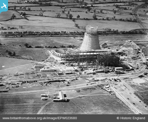
EPW023680 ENGLAND (1928). Hams Hall A Power Station under construction, Curdworth, 1928
© Copyright OpenStreetMap contributors and licensed by the OpenStreetMap Foundation. 2024. Cartography is licensed as CC BY-SA.
Nearby Images (24)
EPW023680

EPW023688

EPW023690

EPW023686

EPW023691

EPW023683

EPW023687

EPW023681

EPW023685

EPW023684

EPW060885

EPW023692

EPW060879

EAW021642

EPW023682

EPW060886

EPW060880

EPW060884

EPW060883

EPW023694

EPW060877

EAW021639

EAW021643

EPW060882

Details
| Title | [EPW023680] Hams Hall A Power Station under construction, Curdworth, 1928 |
| Reference | EPW023680 |
| Date | September-1928 |
| Link | |
| Place name | CURDWORTH |
| Parish | CURDWORTH |
| District | |
| Country | ENGLAND |
| Easting / Northing | 419339, 291978 |
| Longitude / Latitude | -1.7149238164446, 52.524969128323 |
| National Grid Reference | SP193920 |
Pins
Be the first to add a comment to this image!


