
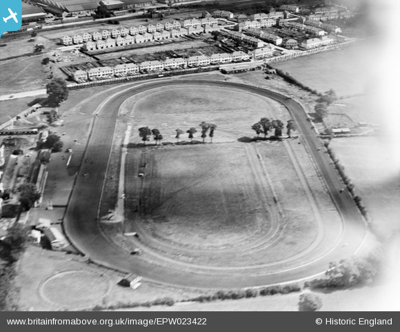
EPW023422 ENGLAND (1928). The Greenford Trotting Track, Greenford, 1928
© Copyright OpenStreetMap contributors and licensed by the OpenStreetMap Foundation. 2024. Cartography is licensed as CC BY-SA.
Nearby Images (10)
EPW023422

EPW034578

EPW023423

EPW023424

EPW034577

EPW023425

EPW034572

EPW034569

EPW034573

EPW034571

Details
| Title | [EPW023422] The Greenford Trotting Track, Greenford, 1928 |
| Reference | EPW023422 |
| Date | September-1928 |
| Link | |
| Place name | GREENFORD |
| Parish | |
| District | |
| Country | ENGLAND |
| Easting / Northing | 514183, 183736 |
| Longitude / Latitude | -0.35334564688017, 51.540479792311 |
| National Grid Reference | TQ142837 |
Pins
User Comment Contributions
Birkbeck Avenue in the foreground with Hill Rise behind. |
 Paul |
Saturday 21st of July 2012 08:10:11 PM |


