
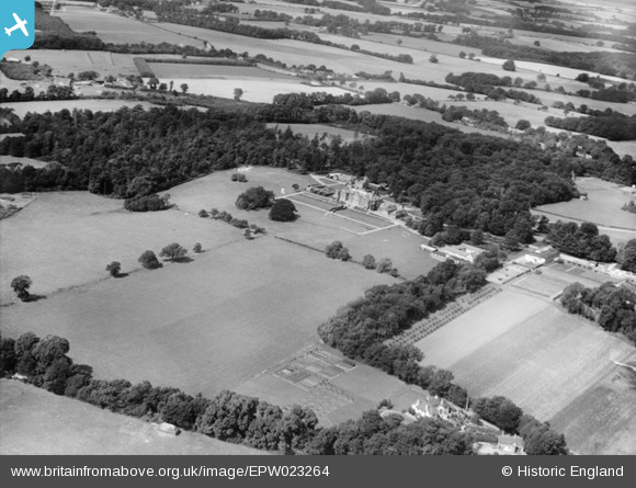
EPW023264 ENGLAND (1928). Clayesmore School and Franklin's Copse, Pangbourne, 1928
© Copyright OpenStreetMap contributors and licensed by the OpenStreetMap Foundation. 2024. Cartography is licensed as CC BY-SA.
Nearby Images (9)
EPW023264

EAW017629

EPW023271

EPW023268

EPW023270

EPW023266

EPW023269

EPW023267

EPW023265

Details
| Title | [EPW023264] Clayesmore School and Franklin's Copse, Pangbourne, 1928 |
| Reference | EPW023264 |
| Date | September-1928 |
| Link | |
| Place name | PANGBOURNE |
| Parish | PANGBOURNE |
| District | |
| Country | ENGLAND |
| Easting / Northing | 461939, 175455 |
| Longitude / Latitude | -1.1080812878444, 51.474176285405 |
| National Grid Reference | SU619755 |
Pins
Be the first to add a comment to this image!


