
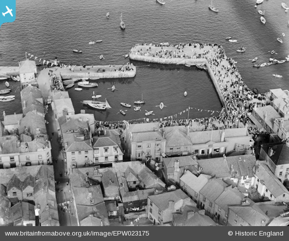
EPW023175 ENGLAND (1928). The Town Quay, Falmouth, 1928
© Copyright OpenStreetMap contributors and licensed by the OpenStreetMap Foundation. 2024. Cartography is licensed as CC BY-SA.
Nearby Images (14)
EPW023175

EPW023182

EPW023184

EPW023183

EPW023180

EPW023173

EPW023179

EPW023172

EPW023181

EPW023177

EPW023185

EPW023174

EPW023178

EPW021723

Details
| Title | [EPW023175] The Town Quay, Falmouth, 1928 |
| Reference | EPW023175 |
| Date | 1-September-1928 |
| Link | |
| Place name | FALMOUTH |
| Parish | FALMOUTH |
| District | |
| Country | ENGLAND |
| Easting / Northing | 181110, 32556 |
| Longitude / Latitude | -5.0644836951686, 50.151960665201 |
| National Grid Reference | SW811326 |
Pins
Be the first to add a comment to this image!


