
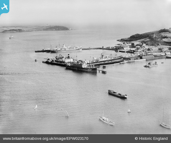
EPW023170 ENGLAND (1928). The Outer Harbour, Falmouth, from the north-west, 1928
© Copyright OpenStreetMap contributors and licensed by the OpenStreetMap Foundation. 2024. Cartography is licensed as CC BY-SA.
Nearby Images (3)
EPW023170

EPW021719

EAW033626

Details
| Title | [EPW023170] The Outer Harbour, Falmouth, from the north-west, 1928 |
| Reference | EPW023170 |
| Date | 1-September-1928 |
| Link | |
| Place name | FALMOUTH |
| Parish | FALMOUTH |
| District | |
| Country | ENGLAND |
| Easting / Northing | 181603, 33069 |
| Longitude / Latitude | -5.0578862038661, 50.156750107573 |
| National Grid Reference | SW816331 |
Pins
 MB |
Friday 26th of October 2012 10:08:06 AM | |
Ampthillmark |
Sunday 7th of October 2012 07:40:35 PM |


