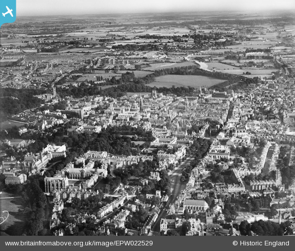
EPW022529 ENGLAND (1928). St Giles' and the city, Oxford, from the north-west, 1928
© Copyright OpenStreetMap contributors and licensed by the OpenStreetMap Foundation. 2024. Cartography is licensed as CC BY-SA.
Nearby Images (14)
EPW022529

EPW038409

EAW003128

EPW022533

EPW022523

EAW045715

EAW003114

EPW022532

EAW003935

EPW038410

EAW045714
 and part of Keble College, Oxford, 1952. This image has been produced from a damaged negative.")
EPW000830

EAW003115

EPW038403

Details
| Title | [EPW022529] St Giles' and the city, Oxford, from the north-west, 1928 |
| Reference | EPW022529 |
| Date | 11-August-1928 |
| Link | |
| Place name | OXFORD |
| Parish | |
| District | |
| Country | ENGLAND |
| Easting / Northing | 451271, 206784 |
| Longitude / Latitude | -1.2570997142958, 51.756941075275 |
| National Grid Reference | SP513068 |
Pins
 Alan McFaden |
Wednesday 17th of July 2013 01:38:45 PM | |
Alan McFaden |
Wednesday 17th of July 2013 01:37:39 PM | |
Alan McFaden |
Wednesday 17th of July 2013 01:36:31 PM | |
Alan McFaden |
Wednesday 17th of July 2013 01:34:10 PM | |
Alan McFaden |
Wednesday 17th of July 2013 01:32:37 PM | |
 Taube |
Thursday 7th of March 2013 03:17:45 PM |