
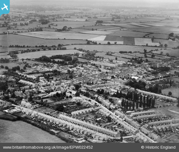
EPW022452 ENGLAND (1928). The town, Stony Stratford, from the north-east, 1928
© Copyright OpenStreetMap contributors and licensed by the OpenStreetMap Foundation. 2024. Cartography is licensed as CC BY-SA.
Nearby Images (3)
EPW022452

EPW022485

EPW036314

Details
| Title | [EPW022452] The town, Stony Stratford, from the north-east, 1928 |
| Reference | EPW022452 |
| Date | August-1928 |
| Link | |
| Place name | STONY STRATFORD |
| Parish | STONY STRATFORD |
| District | |
| Country | ENGLAND |
| Easting / Northing | 479060, 240470 |
| Longitude / Latitude | -0.84678720861542, 52.056546802018 |
| National Grid Reference | SP791405 |
Pins
Be the first to add a comment to this image!


