
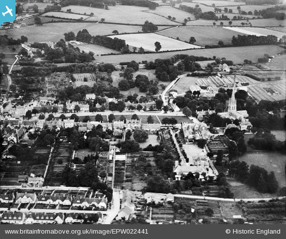
EPW022441 ENGLAND (1928). Church Green and St Mary's Church, Witney, 1928
© Copyright OpenStreetMap contributors and licensed by the OpenStreetMap Foundation. 2024. Cartography is licensed as CC BY-SA.
Nearby Images (7)
EPW022441

EPW022440

EPW014670

EPW054598

EPW054599

EPW038399

EPW022435

Details
| Title | [EPW022441] Church Green and St Mary's Church, Witney, 1928 |
| Reference | EPW022441 |
| Date | August-1928 |
| Link | |
| Place name | WITNEY |
| Parish | WITNEY |
| District | |
| Country | ENGLAND |
| Easting / Northing | 435648, 209382 |
| Longitude / Latitude | -1.4831931304519, 51.781514225337 |
| National Grid Reference | SP356094 |
Pins
 Eagle eye |
Sunday 8th of February 2015 08:58:38 PM | |
Eagle eye |
Sunday 8th of February 2015 08:56:54 PM | |
Eagle eye |
Sunday 8th of February 2015 08:54:59 PM | |
Eagle eye |
Sunday 8th of February 2015 08:52:27 PM |


