
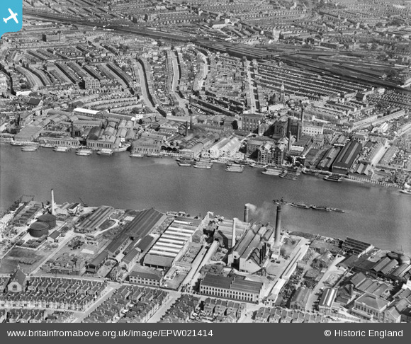
EPW021414 ENGLAND (1928). Price's Belmont Candle and Soap Works, the Sugar Works and environs, Battersea, 1928
© Copyright OpenStreetMap contributors and licensed by the OpenStreetMap Foundation. 2024. Cartography is licensed as CC BY-SA.
Nearby Images (26)
EPW021414

EPW021410

EPW041103

EPW021417

EPW021415

EPW041105

EPW041102

EPW021413

EPW021412

EPW021418

EPW041100

EPW021416

EPW053655

EPW059341

EPW041104

EPW041106

EPW041107

EPW041101

EPW021411

EPW052469

EPW052470

EPW052470A

EPW052472

EPW052473

EPW052681

EPW052471

Details
| Title | [EPW021414] Price's Belmont Candle and Soap Works, the Sugar Works and environs, Battersea, 1928 |
| Reference | EPW021414 |
| Date | 30-May-1928 |
| Link | |
| Place name | BATTERSEA |
| Parish | |
| District | |
| Country | ENGLAND |
| Easting / Northing | 526451, 175869 |
| Longitude / Latitude | -0.17933901783014, 51.467156042255 |
| National Grid Reference | TQ265759 |
Pins
 Class31 |
Monday 4th of March 2013 02:48:54 PM | |
Class31 |
Monday 4th of March 2013 02:37:53 PM | |
Class31 |
Monday 4th of March 2013 02:33:57 PM | |
Class31 |
Monday 4th of March 2013 02:31:12 PM | |
Class31 |
Monday 4th of March 2013 02:28:29 PM | |
Class31 |
Monday 4th of March 2013 02:25:39 PM | |
Class31 |
Monday 4th of March 2013 02:23:12 PM |
User Comment Contributions
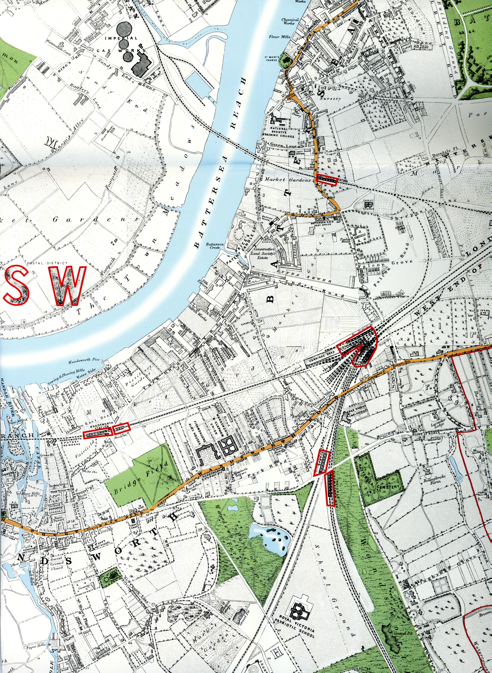 The attached scan of an 1863 map shows Price's Candle Company Works on the edge of Battersea Creek. On the other side of the creek used to be a silk factory and behind that on the corner of York Place & York Road was a row of cottages called Ford's Buildings where my great great great grandfather lived in 1841. |
 melgibbs |
Sunday 20th of April 2014 06:19:44 PM |


