
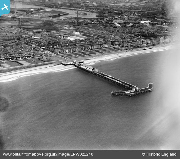
EPW021240 ENGLAND (1928). Claremont Pier and South Beach, Lowestoft, 1928
© Copyright OpenStreetMap contributors and licensed by the OpenStreetMap Foundation. 2024. Cartography is licensed as CC BY-SA.
Nearby Images (6)
EPW021240

EPW001897

EAW025477

EPW021247

EAW025478

EAW005062

Details
| Title | [EPW021240] Claremont Pier and South Beach, Lowestoft, 1928 |
| Reference | EPW021240 |
| Date | May-1928 |
| Link | |
| Place name | LOWESTOFT |
| Parish | |
| District | |
| Country | ENGLAND |
| Easting / Northing | 654582, 291876 |
| Longitude / Latitude | 1.748374194555, 52.464985400174 |
| National Grid Reference | TM546919 |


