
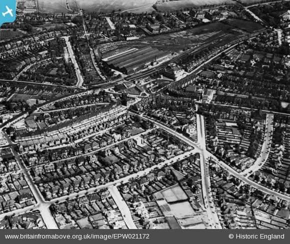
EPW021172 ENGLAND (1928). Golders Green Station and environs, Golders Green, 1928. This image has been produced from a print.
© Copyright OpenStreetMap contributors and licensed by the OpenStreetMap Foundation. 2024. Cartography is licensed as CC BY-SA.
Nearby Images (15)
EPW021172

EPW005990

EPW045379

EPW028190

EPW000810

EPW028182

EPW008218
 extension from Golders Green to Hendon and Edgware under construction, Child's Hill, 1922. This image has been produced from a copy-negative.")
EPW009094

EPW009535

EPW008214

EPW024243

EPW047879

EPW009095

EPW028188

EPW028180

Details
| Title | [EPW021172] Golders Green Station and environs, Golders Green, 1928. This image has been produced from a print. |
| Reference | EPW021172 |
| Date | April-1928 |
| Link | |
| Place name | GOLDERS GREEN |
| Parish | |
| District | |
| Country | ENGLAND |
| Easting / Northing | 525079, 187395 |
| Longitude / Latitude | -0.19499090563676, 51.571056944329 |
| National Grid Reference | TQ251874 |
Pins
Be the first to add a comment to this image!


