
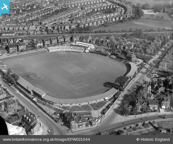
EPW021044 ENGLAND (1928). Trent Bridge Cricket Ground, West Bridgford, 1928
© Copyright OpenStreetMap contributors and licensed by the OpenStreetMap Foundation. 2024. Cartography is licensed as CC BY-SA.
Nearby Images (8)
EPW021044

EPW021045

EAW042520

EAW050482

EPR000148

EPR000153

EAW050483

EAW042519

Details
| Title | [EPW021044] Trent Bridge Cricket Ground, West Bridgford, 1928 |
| Reference | EPW021044 |
| Date | April-1928 |
| Link | |
| Place name | WEST BRIDGFORD |
| Parish | |
| District | |
| Country | ENGLAND |
| Easting / Northing | 458461, 338047 |
| Longitude / Latitude | -1.1300692323404, 52.936317469858 |
| National Grid Reference | SK585380 |
Pins
 Dom Sweeney |
Monday 21st of October 2013 07:49:53 PM | |
Dom Sweeney |
Monday 21st of October 2013 07:49:06 PM | |
 Class31 |
Monday 24th of June 2013 04:03:47 PM | |
Class31 |
Monday 24th of June 2013 04:02:43 PM | |
Class31 |
Monday 24th of June 2013 04:02:02 PM | |
Class31 |
Monday 24th of June 2013 04:01:22 PM | |
MB |
Tuesday 16th of October 2012 03:55:06 PM |


