
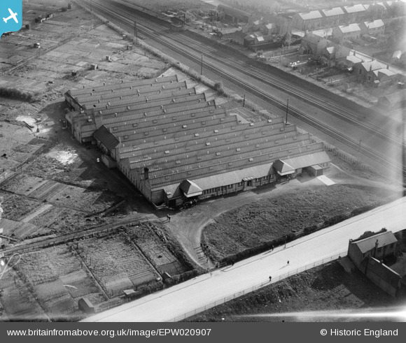
EPW020907 ENGLAND (1928). The Shepshed Lace Company Works, Loughborough, 1928
© Copyright OpenStreetMap contributors and licensed by the OpenStreetMap Foundation. 2024. Cartography is licensed as CC BY-SA.
Nearby Images (7)
EPW020907

EPW020909

EPW020904

EPW020905

EPW020908

EPW020910

EPW020906

Details
| Title | [EPW020907] The Shepshed Lace Company Works, Loughborough, 1928 |
| Reference | EPW020907 |
| Date | April-1928 |
| Link | |
| Place name | LOUGHBOROUGH |
| Parish | |
| District | |
| Country | ENGLAND |
| Easting / Northing | 454429, 319253 |
| Longitude / Latitude | -1.1931995873548, 52.767791964374 |
| National Grid Reference | SK544193 |
Pins
 John Wass |
Friday 28th of December 2018 02:18:08 PM | |
John Wass |
Friday 28th of October 2016 08:00:47 PM |


