
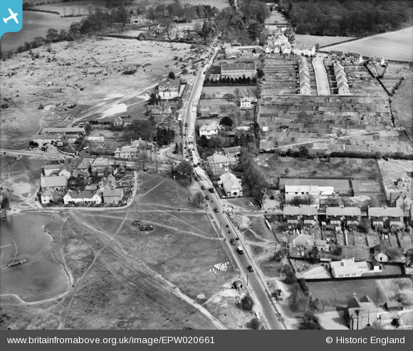
EPW020661 ENGLAND (1928). The Brighton Road (A217), Burgh Heath, 1928
© Copyright OpenStreetMap contributors and licensed by the OpenStreetMap Foundation. 2024. Cartography is licensed as CC BY-SA.
Nearby Images (3)
EPW020661
, Burgh Heath, 1928")
EPW020656
, Burgh Heath, 1928")
EPW020657
, Burgh Heath, 1928")
Details
| Title | [EPW020661] The Brighton Road (A217), Burgh Heath, 1928 |
| Reference | EPW020661 |
| Date | March-1928 |
| Link | |
| Place name | BURGH HEATH |
| Parish | |
| District | |
| Country | ENGLAND |
| Easting / Northing | 524219, 157787 |
| Longitude / Latitude | -0.21778526326184, 51.305123827763 |
| National Grid Reference | TQ242578 |


