
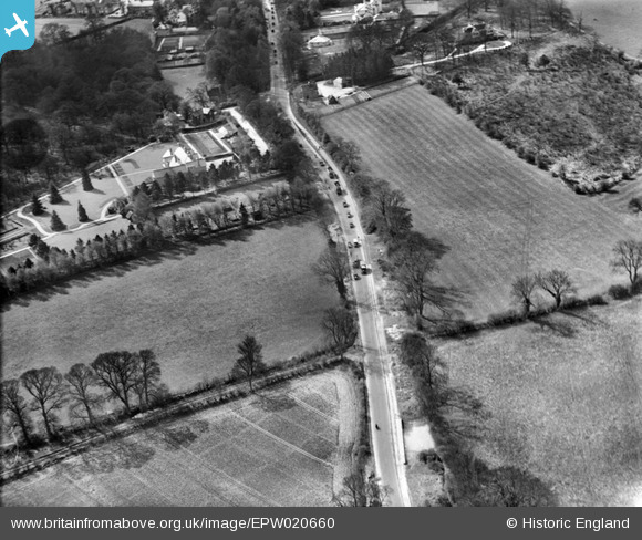
EPW020660 ENGLAND (1928). The Brighton Road (A217) to the south of Banstead, Burgh Heath, 1928
© Copyright OpenStreetMap contributors and licensed by the OpenStreetMap Foundation. 2024. Cartography is licensed as CC BY-SA.
Nearby Images (2)
EPW020660
 to the south of Banstead, Burgh Heath, 1928")
EPW020665
, Burgh Heath, 1928")
Details
| Title | [EPW020660] The Brighton Road (A217) to the south of Banstead, Burgh Heath, 1928 |
| Reference | EPW020660 |
| Date | March-1928 |
| Link | |
| Place name | BURGH HEATH |
| Parish | |
| District | |
| Country | ENGLAND |
| Easting / Northing | 524535, 158434 |
| Longitude / Latitude | -0.21302793386546, 51.310870272377 |
| National Grid Reference | TQ245584 |
Pins
 crepello |
Tuesday 16th of February 2016 01:19:02 AM | |
crepello |
Monday 15th of February 2016 11:15:08 PM | |
crepello |
Monday 15th of February 2016 11:08:54 PM | |
crepello |
Monday 15th of February 2016 10:25:08 PM | |
crepello |
Monday 15th of February 2016 10:16:26 PM |


