
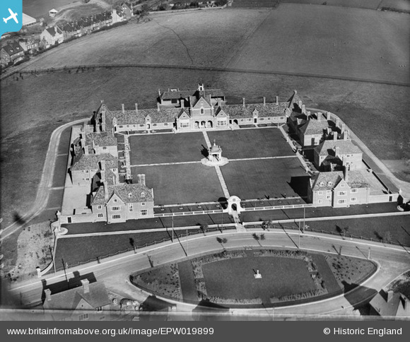
EPW019899 ENGLAND (1927). Foord Almshouses, Borstal, 1927
© Copyright OpenStreetMap contributors and licensed by the OpenStreetMap Foundation. 2024. Cartography is licensed as CC BY-SA.
Nearby Images (4)
EPW019899

EPW019896

EPW019898

EPW019897

Details
| Title | [EPW019899] Foord Almshouses, Borstal, 1927 |
| Reference | EPW019899 |
| Date | October-1927 |
| Link | |
| Place name | BORSTAL |
| Parish | |
| District | |
| Country | ENGLAND |
| Easting / Northing | 573706, 167122 |
| Longitude / Latitude | 0.49615761541023, 51.376041302675 |
| National Grid Reference | TQ737671 |
Pins
Be the first to add a comment to this image!


