
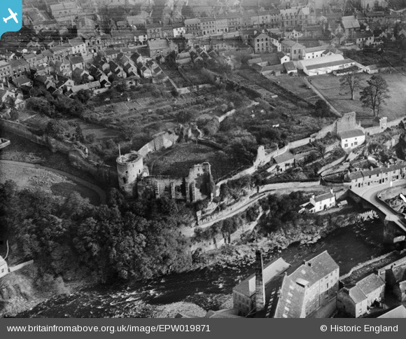
EPW019871 ENGLAND (1927). The Castle Ruins, Barnard Castle, 1927
© Copyright OpenStreetMap contributors and licensed by the OpenStreetMap Foundation. 2024. Cartography is licensed as CC BY-SA.
Nearby Images (9)
EPW019871

EAW005567

EAW005566

EAW005569

EAW005568

EAW005570

EPW019872

EPW019874

EPW019875

Details
| Title | [EPW019871] The Castle Ruins, Barnard Castle, 1927 |
| Reference | EPW019871 |
| Date | October-1927 |
| Link | |
| Place name | BARNARD CASTLE |
| Parish | BARNARD CASTLE |
| District | |
| Country | ENGLAND |
| Easting / Northing | 404852, 516456 |
| Longitude / Latitude | -1.9249925791955, 54.54321453434 |
| National Grid Reference | NZ049165 |
Pins
User Comment Contributions
Ullathorne's Mill was completed in 1798 and was used to produce shoe thread from flax imported from Belgium, Ireland, France and Russia. Thread was exported. A hundred men were employed here together with a further hundred women and children. The mill closed circa 1938 and was demolished in 1975. [From short video clip online] |
 MB |
Saturday 8th of October 2016 10:46:33 PM |
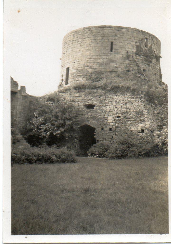 An original snapshot of "The Castle Keep" taken June or July 1939 |
 Class31 |
Thursday 15th of May 2014 06:08:58 PM |
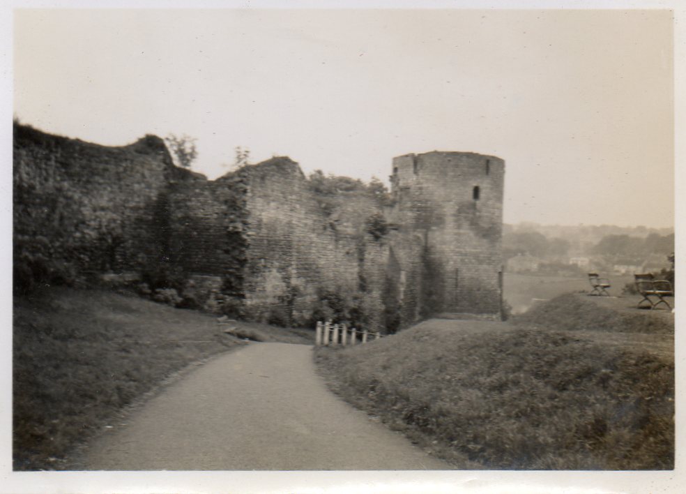 An original snapshot of "The Castle Enciente" taken June or July 1939 |
Class31 |
Thursday 15th of May 2014 06:07:00 PM |
 Barnard Castle |
Robert - Cumbria |
Tuesday 26th of June 2012 11:57:38 PM |
Impressive ramparts! |
Tommy Brown |
Thursday 14th of June 2012 09:26:16 AM |
Not in Scotland... But does have lots of Scottish connections, including being built by the Balliol family, and besieged by the supporters of Mary Queen of Scots. |
Alan McFarlane |
Thursday 14th of June 2012 09:26:16 AM |


