
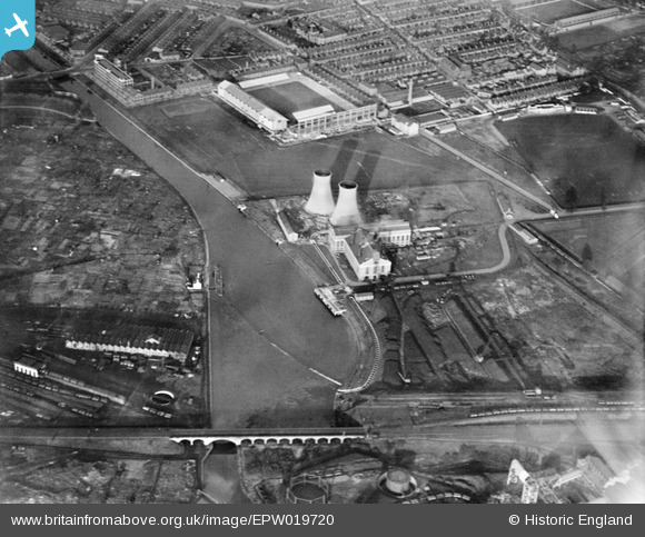
EPW019720 ENGLAND (1927). Power Station at Freeman's Wharf (now the site of the King Power Stadium) and environs, Leicester, 1927
© Copyright OpenStreetMap contributors and licensed by the OpenStreetMap Foundation. 2024. Cartography is licensed as CC BY-SA.
Nearby Images (15)
EPW019720
 and environs, Leicester, 1927")
EPW019717
, Leicester, 1927")
EPW019716
, Leicester, 1927")
EPW019719
 and environs, Leicester, 1927")
EPW019718
, Leicester, 1927")
EPW021006

EAW001143

EAW001136

EAW001140

EAW001137

EPW047635

EAW001142

EAW001138

EAW001141

EAW001139

Details
| Title | [EPW019720] Power Station at Freeman's Wharf (now the site of the King Power Stadium) and environs, Leicester, 1927 |
| Reference | EPW019720 |
| Date | October-1927 |
| Link | |
| Place name | LEICESTER |
| Parish | |
| District | |
| Country | ENGLAND |
| Easting / Northing | 458097, 302954 |
| Longitude / Latitude | -1.141713901697, 52.620887188206 |
| National Grid Reference | SK581030 |
Pins
 Class31 |
Sunday 10th of February 2013 09:46:23 PM | |
Class31 |
Sunday 10th of February 2013 05:55:13 PM | |
Class31 |
Sunday 10th of February 2013 05:53:27 PM | |
Class31 |
Sunday 10th of February 2013 05:50:54 PM | |
Class31 |
Sunday 10th of February 2013 05:47:25 PM |


