
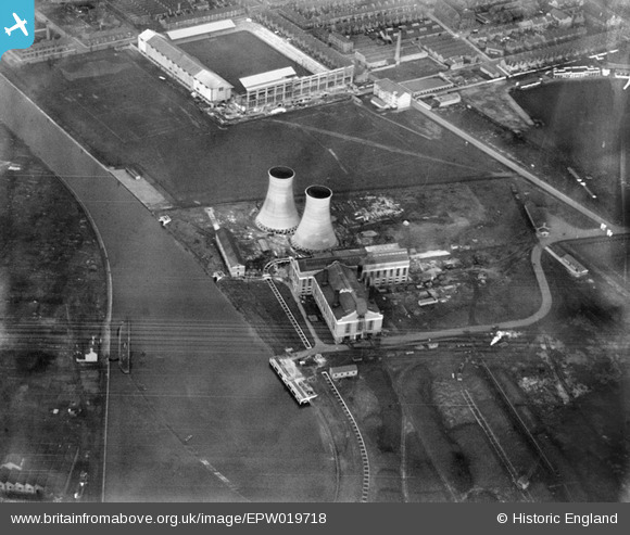
EPW019718 ENGLAND (1927). Power Station at Freeman's Wharf (now the site of the King Power Stadium), Leicester, 1927
© Copyright OpenStreetMap contributors and licensed by the OpenStreetMap Foundation. 2024. Cartography is licensed as CC BY-SA.
Nearby Images (17)
EPW019718
, Leicester, 1927")
EPW019717
, Leicester, 1927")
EPW019720
 and environs, Leicester, 1927")
EPW019716
, Leicester, 1927")
EPW019719
 and environs, Leicester, 1927")
EAW001143

EAW001136

EAW001140

EPW021006

EAW001137

EAW001142

EAW001138

EAW001141

EAW001139

EPW008511

EPW047635

EAW045099

Details
| Title | [EPW019718] Power Station at Freeman's Wharf (now the site of the King Power Stadium), Leicester, 1927 |
| Reference | EPW019718 |
| Date | October-1927 |
| Link | |
| Place name | LEICESTER |
| Parish | |
| District | |
| Country | ENGLAND |
| Easting / Northing | 458140, 302981 |
| Longitude / Latitude | -1.1410739747739, 52.621125308811 |
| National Grid Reference | SK581030 |
Pins
 Class31 |
Sunday 10th of February 2013 05:54:55 PM | |
Class31 |
Sunday 10th of February 2013 05:52:54 PM | |
Class31 |
Sunday 10th of February 2013 05:51:33 PM | |
The double deck South Stand under construction. |
 gBr |
Saturday 29th of November 2014 12:42:05 AM |
Class31 |
Sunday 10th of February 2013 05:46:55 PM |


