
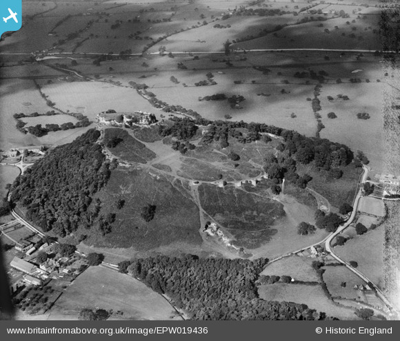
EPW019436 ENGLAND (1927). Beeston Castle, Beeston, 1927
© Copyright OpenStreetMap contributors and licensed by the OpenStreetMap Foundation. 2024. Cartography is licensed as CC BY-SA.
Nearby Images (13)
EPW019436

EAW013789

EPW019438

EPW040170

EAW013792

EAW013790

EAW013793

EPW040172

EPW040171

EPW019437

EAW000832

EAW013794

EAW013791

Details
| Title | [EPW019436] Beeston Castle, Beeston, 1927 |
| Reference | EPW019436 |
| Date | October-1927 |
| Link | |
| Place name | BEESTON |
| Parish | BEESTON |
| District | |
| Country | ENGLAND |
| Easting / Northing | 353820, 359166 |
| Longitude / Latitude | -2.6902239673796, 53.12736427709 |
| National Grid Reference | SJ538592 |
Pins
Be the first to add a comment to this image!
User Comment Contributions
 Beeston Castle now run by English Heritage. There are a couple of hills on the plain that command the whole area. Beeston Castle is on one and Peckforton Castle is on the other. http://goo.gl/rRfUT |
 BruceR |
Wednesday 5th of December 2012 09:53:05 PM |


