
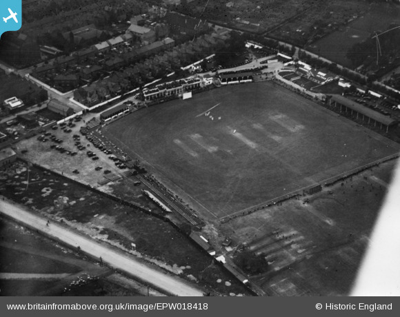
EPW018418 ENGLAND (1927). The County Cricket Ground, Leicester, 1927. This image has been produced from a print.
© Copyright OpenStreetMap contributors and licensed by the OpenStreetMap Foundation. 2024. Cartography is licensed as CC BY-SA.
Nearby Images (17)
EPW018418

EAW001141

EAW001139

EAW045094

EAW045095

EAW045098

EAW001137

EAW001142

EAW045093

EAW045099

EAW045096

EAW001140

EAW001136

EAW001138

EAW045097

EAW051832

EPW008511

Details
| Title | [EPW018418] The County Cricket Ground, Leicester, 1927. This image has been produced from a print. |
| Reference | EPW018418 |
| Date | 10-June-1927 |
| Link | |
| Place name | LEICESTER |
| Parish | |
| District | |
| Country | ENGLAND |
| Easting / Northing | 458464, 302988 |
| Longitude / Latitude | -1.1362867415938, 52.62115344054 |
| National Grid Reference | SK585030 |
Pins
Be the first to add a comment to this image!


