
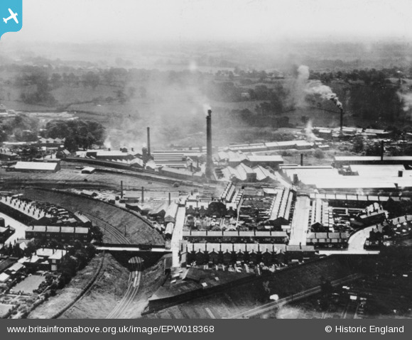
EPW018368 ENGLAND (1927). The King's Norton Metal Works (later Birmingham Factory Centre), Cotteridge Road and environs, Cotteridge, from the north-west, 1927. This image has been produced from a copy-negative.
© Copyright OpenStreetMap contributors and licensed by the OpenStreetMap Foundation. 2024. Cartography is licensed as CC BY-SA.
Nearby Images (4)
EPW018368
, Cotteridge Road and environs, Cotteridge, from the north-west, 1927. This image has been produced from a copy-negative.")
EPW050078

EPW050079

EPW018377
, King's Norton, 1927. This image has been produced from a copy-negative.")
Details
| Title | [EPW018368] The King's Norton Metal Works (later Birmingham Factory Centre), Cotteridge Road and environs, Cotteridge, from the north-west, 1927. This image has been produced from a copy-negative. |
| Reference | EPW018368 |
| Date | 10-June-1927 |
| Link | |
| Place name | COTTERIDGE |
| Parish | |
| District | |
| Country | ENGLAND |
| Easting / Northing | 405148, 279959 |
| Longitude / Latitude | -1.9242985048562, 52.417225105477 |
| National Grid Reference | SP051800 |
Pins
Be the first to add a comment to this image!


