
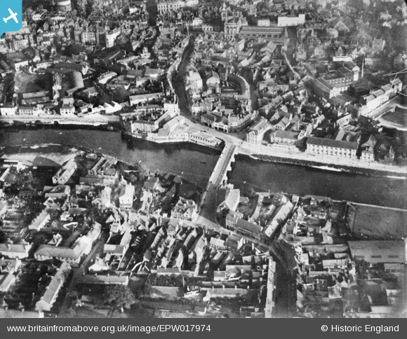
EPW017974 ENGLAND (1927). Welsh Bridge, Shrewsbury, 1927. This image has been produced from a copy-negative.
© Copyright OpenStreetMap contributors and licensed by the OpenStreetMap Foundation. 2024. Cartography is licensed as CC BY-SA.
Nearby Images (8)
EPW017974

EAW001629

EPW040077

EPW017973

EAW012517

EAW001631

EPW017983

EAW001634

Details
| Title | [EPW017974] Welsh Bridge, Shrewsbury, 1927. This image has been produced from a copy-negative. |
| Reference | EPW017974 |
| Date | 3-May-1927 |
| Link | |
| Place name | SHREWSBURY |
| Parish | SHREWSBURY |
| District | |
| Country | ENGLAND |
| Easting / Northing | 348919, 312764 |
| Longitude / Latitude | -2.7561676361014, 52.709784045083 |
| National Grid Reference | SJ489128 |
Pins
Be the first to add a comment to this image!


