
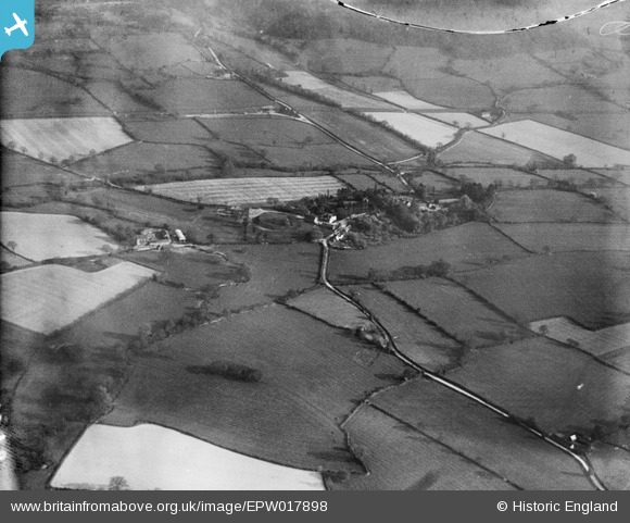
EPW017898 ENGLAND (1927). The Castle Mound and the village, Rushbury, 1927
© Copyright OpenStreetMap contributors and licensed by the OpenStreetMap Foundation. 2024. Cartography is licensed as CC BY-SA.
Nearby Images (4)
EPW017898

EPW017900

EPW017902

EPW017899

Details
| Title | [EPW017898] The Castle Mound and the village, Rushbury, 1927 |
| Reference | EPW017898 |
| Date | 11-May-1927 |
| Link | |
| Place name | RUSHBURY |
| Parish | RUSHBURY |
| District | |
| Country | ENGLAND |
| Easting / Northing | 351388, 291973 |
| Longitude / Latitude | -2.7165630799136, 52.523098454887 |
| National Grid Reference | SO514920 |
Pins

User Comment Contributions
See also EPW017891 to EPW017905 (excluding EPW017903) |
 BigglesH |
Monday 23rd of July 2012 07:28:51 PM |


