
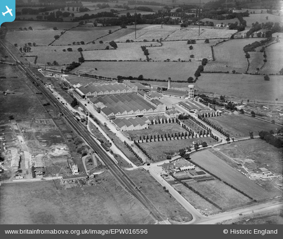
EPW016596 ENGLAND (1926). The Greenford Factories, Greenford, 1926
© Copyright OpenStreetMap contributors and licensed by the OpenStreetMap Foundation. 2024. Cartography is licensed as CC BY-SA.
Nearby Images (19)
EPW016596

EPR000635

EPW031778

EPW016594

EPW009436

EPW016598

EPW016603

EPW016597

EPW016604

EPW016599

EPW016600

EPW008030

EPW016595

EPW016602

EPW008029

EPW016601

EPW006964

EPW031777

EPW031779

Details
| Title | [EPW016596] The Greenford Factories, Greenford, 1926 |
| Reference | EPW016596 |
| Date | 26-August-1926 |
| Link | |
| Place name | GREENFORD |
| Parish | |
| District | |
| Country | ENGLAND |
| Easting / Northing | 514633, 184127 |
| Longitude / Latitude | -0.34673162765748, 51.543903139074 |
| National Grid Reference | TQ146841 |
Pins
 Des Elmes |
Thursday 14th of April 2016 04:43:31 PM | |
 Paul |
Sunday 29th of July 2012 10:59:16 AM | |
what was the Greenford Radio station? |
SimonRoberts |
Monday 29th of April 2013 09:32:39 PM |
Mike |
Friday 27th of July 2012 12:29:10 PM |


