
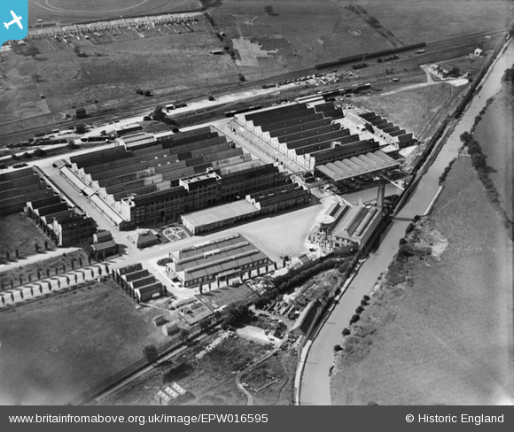
EPW016595 ENGLAND (1926). The Greenford Factories, Greenford, 1926
© Copyright OpenStreetMap contributors and licensed by the OpenStreetMap Foundation. 2024. Cartography is licensed as CC BY-SA.
Nearby Images (19)
EPW016595

EPW016604

EPW016597

EPW016599

EPW016600

EPW016603

EPW016601

EPW009436

EPW006964

EPW016602

EPW016596

EPW031778

EPW016594

EPW031777

EPR000635

EPW016598

EPW008029

EPW008030

EPW031779

Details
| Title | [EPW016595] The Greenford Factories, Greenford, 1926 |
| Reference | EPW016595 |
| Date | 26-August-1926 |
| Link | |
| Place name | GREENFORD |
| Parish | |
| District | |
| Country | ENGLAND |
| Easting / Northing | 514572, 184223 |
| Longitude / Latitude | -0.34757972874746, 51.544778443585 |
| National Grid Reference | TQ146842 |
Pins
Be the first to add a comment to this image!


