
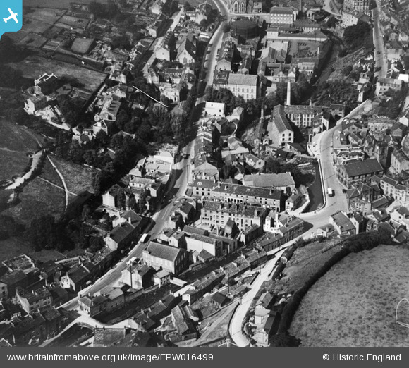
EPW016499 ENGLAND (1926). Victoria Square and the town centre, Holmfirth, 1926
© Copyright OpenStreetMap contributors and licensed by the OpenStreetMap Foundation. 2024. Cartography is licensed as CC BY-SA.
Nearby Images (4)
EPW016499

EPW016495

EPW016497

EPW016494

Details
| Title | [EPW016499] Victoria Square and the town centre, Holmfirth, 1926 |
| Reference | EPW016499 |
| Date | August-1926 |
| Link | |
| Place name | HOLMFIRTH |
| Parish | HOLME VALLEY |
| District | |
| Country | ENGLAND |
| Easting / Northing | 414189, 408220 |
| Longitude / Latitude | -1.7857181640153, 53.570153029668 |
| National Grid Reference | SE142082 |
Pins
 mr |
Sunday 14th of February 2021 08:30:26 AM | |
Allan |
Tuesday 24th of September 2013 10:59:04 PM | |
Allan |
Tuesday 24th of September 2013 10:57:53 PM | |
A. Teri |
Tuesday 4th of September 2012 09:09:54 PM |


