
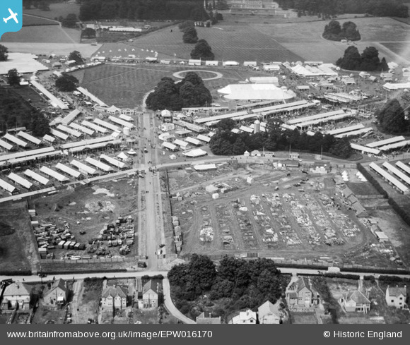
EPW016170 ENGLAND (1926). Caversham Park, the Royal Agricultural Show, 1926
© Copyright OpenStreetMap contributors and licensed by the OpenStreetMap Foundation. 2024. Cartography is licensed as CC BY-SA.
Nearby Images (4)
EPW016170

EPW016168

EPW016171

EPW016167

Details
| Title | [EPW016170] Caversham Park, the Royal Agricultural Show, 1926 |
| Reference | EPW016170 |
| Date | 2-July-1926 |
| Link | |
| Place name | CAVERSHAM PARK |
| Parish | |
| District | |
| Country | ENGLAND |
| Easting / Northing | 472817, 175380 |
| Longitude / Latitude | -0.95148015497777, 51.472206130833 |
| National Grid Reference | SU728754 |
Pins
User Comment Contributions
 The area for Henley Road Allotments was reserved at the end of the show and is in the top left hand corner. |
 Evelyn |
Wednesday 19th of June 2013 09:54:13 AM |


