
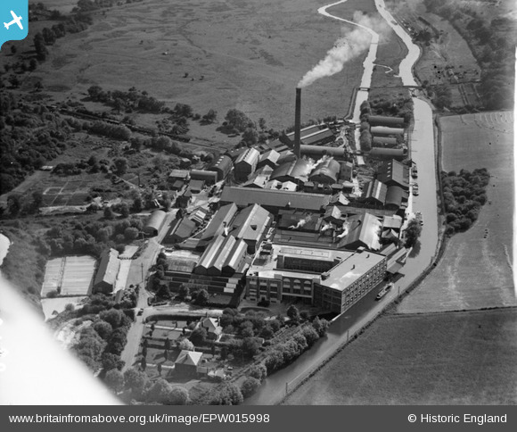
EPW015998 ENGLAND (1926). The Croxley Paper Mills, Croxley Green, 1926
© Copyright OpenStreetMap contributors and licensed by the OpenStreetMap Foundation. 2024. Cartography is licensed as CC BY-SA.
Nearby Images (21)
EPW015998

EPW015996

EPW039596

EAW048395

EPW039591

EPW039595

EAW048396

EAW048391

EPW015995

EAW048397

EAW048393

EPW019274

EPW019275

EPW039592

EPW039590

EPW039597

EAW048394

EPW039593

EPW039594

EPW015997

EAW048392

Details
| Title | [EPW015998] The Croxley Paper Mills, Croxley Green, 1926 |
| Reference | EPW015998 |
| Date | 30-June-1926 |
| Link | |
| Place name | CROXLEY GREEN |
| Parish | CROXLEY GREEN |
| District | |
| Country | ENGLAND |
| Easting / Northing | 508445, 195365 |
| Longitude / Latitude | -0.43246543640404, 51.646144792615 |
| National Grid Reference | TQ084954 |
Pins
Be the first to add a comment to this image!


