
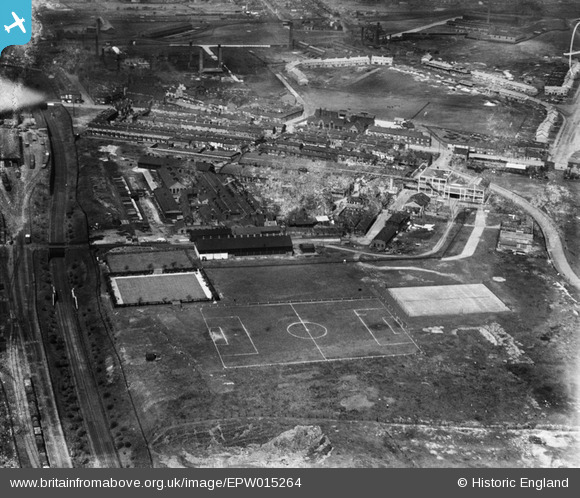
EPW015264 ENGLAND (1926). The Chillington Tool Works, Wolverhampton, 1926
© Copyright OpenStreetMap contributors and licensed by the OpenStreetMap Foundation. 2024. Cartography is licensed as CC BY-SA.
Nearby Images (3)
EPW015264

EPW015266

EPW015265

Details
| Title | [EPW015264] The Chillington Tool Works, Wolverhampton, 1926 |
| Reference | EPW015264 |
| Date | April-1926 |
| Link | |
| Place name | WOLVERHAMPTON |
| Parish | |
| District | |
| Country | ENGLAND |
| Easting / Northing | 392903, 298149 |
| Longitude / Latitude | -2.1047495153435, 52.580748915164 |
| National Grid Reference | SO929981 |
Pins
 DebbieA |
Sunday 26th of January 2020 07:01:35 PM | |
DebbieA |
Sunday 26th of January 2020 07:00:14 PM | |
alan alcock |
Tuesday 28th of February 2017 05:23:47 PM | |
alan alcock |
Tuesday 28th of February 2017 05:22:20 PM | |
alan alcock |
Tuesday 28th of February 2017 05:20:21 PM | |
alan alcock |
Tuesday 28th of February 2017 05:19:39 PM | |
alan alcock |
Tuesday 28th of February 2017 05:18:39 PM | |
alan alcock |
Tuesday 28th of February 2017 05:17:57 PM | |
alan alcock |
Tuesday 28th of February 2017 05:17:06 PM | |
alan alcock |
Tuesday 28th of February 2017 05:16:17 PM | |
alan alcock |
Tuesday 28th of February 2017 05:15:11 PM |


