
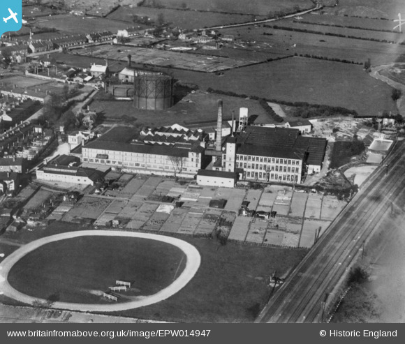
EPW014947 ENGLAND (1926). The Wyvern Worsted Mills, Melton Mowbray, 1926. This image has been produced from a copy-negative.
© Copyright OpenStreetMap contributors and licensed by the OpenStreetMap Foundation. 2024. Cartography is licensed as CC BY-SA.
Nearby Images (7)
EPW014947

EPW058211

EPW058171

EPW058169

EPW058168

EPW058170

EPW058213

Details
| Title | [EPW014947] The Wyvern Worsted Mills, Melton Mowbray, 1926. This image has been produced from a copy-negative. |
| Reference | EPW014947 |
| Date | 11-April-1926 |
| Link | |
| Place name | MELTON MOWBRAY |
| Parish | |
| District | |
| Country | ENGLAND |
| Easting / Northing | 475691, 318856 |
| Longitude / Latitude | -0.87818153746094, 52.761661880888 |
| National Grid Reference | SK757189 |
Pins
Be the first to add a comment to this image!


