
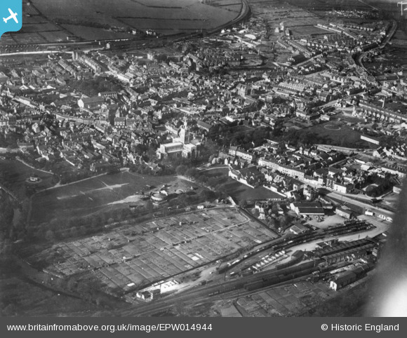
EPW014944 ENGLAND (1926). The town, Melton Mowbray, 1926. This image has been produced from a copy-negative.
© Copyright OpenStreetMap contributors and licensed by the OpenStreetMap Foundation. 2024. Cartography is licensed as CC BY-SA.
Nearby Images (11)
EPW014944

EPW014943

EPW014945

EPW058212

EPW058214

EAW042527

EAW049203

EPW014941

EAW049204

EPW058210

EAW042526

Details
| Title | [EPW014944] The town, Melton Mowbray, 1926. This image has been produced from a copy-negative. |
| Reference | EPW014944 |
| Date | 11-April-1926 |
| Link | |
| Place name | MELTON MOWBRAY |
| Parish | |
| District | |
| Country | ENGLAND |
| Easting / Northing | 475290, 319001 |
| Longitude / Latitude | -0.88409021832257, 52.763021311917 |
| National Grid Reference | SK753190 |
Pins
Be the first to add a comment to this image!


