
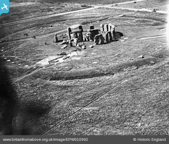
EPW010992 ENGLAND (1924). Stonehenge, Stonehenge, 1924. This image has been produced from a copy-negative.
© Copyright OpenStreetMap contributors and licensed by the OpenStreetMap Foundation. 2024. Cartography is licensed as CC BY-SA.
Nearby Images (8)
EPW010992

EAW015765

EAW003338

EPW010990

EAW003339

EAW003337

EAW015764

EAW003340

Details
| Title | [EPW010992] Stonehenge, Stonehenge, 1924. This image has been produced from a copy-negative. |
| Reference | EPW010992 |
| Date | 10-July-1924 |
| Link | |
| Place name | STONEHENGE |
| Parish | AMESBURY |
| District | |
| Country | ENGLAND |
| Easting / Northing | 412270, 142155 |
| Longitude / Latitude | -1.8244486482709, 51.177977030713 |
| National Grid Reference | SU123422 |
Pins


User Comment Contributions
 Stonehenge, 09/03/2015 |
 Class31 |
Sunday 15th of March 2015 07:22:21 PM |
 Stonehenge 1980's |
 Alan McFaden |
Thursday 20th of November 2014 09:05:31 PM |
 Stonehenge |
Alan McFaden |
Wednesday 12th of November 2014 05:16:56 PM |


