
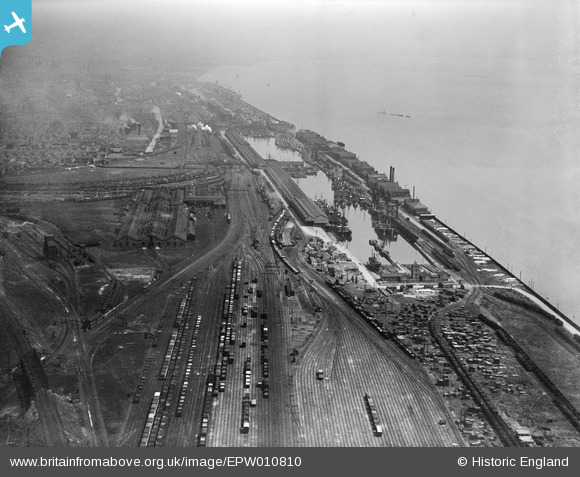
EPW010810 ENGLAND (1924). St Andrew's Dock and the Inward and Outward Goods Sidings, Kingston upon Hull, from the west, 1924
© Copyright OpenStreetMap contributors and licensed by the OpenStreetMap Foundation. 2024. Cartography is licensed as CC BY-SA.
Nearby Images (2)
EPW010810

EPW036549

Details
| Title | [EPW010810] St Andrew's Dock and the Inward and Outward Goods Sidings, Kingston upon Hull, from the west, 1924 |
| Reference | EPW010810 |
| Date | June-1924 |
| Link | |
| Place name | KINGSTON UPON HULL |
| Parish | |
| District | |
| Country | ENGLAND |
| Easting / Northing | 506606, 426706 |
| Longitude / Latitude | -0.38404377748821, 53.725623937078 |
| National Grid Reference | TA066267 |
Pins
 Philip |
Thursday 29th of January 2015 02:04:42 AM | |
John Wass |
Saturday 30th of August 2014 04:12:58 PM | |
 |
John Wass |
Tuesday 19th of August 2014 04:37:31 PM |
John Wass |
Tuesday 19th of August 2014 04:28:39 PM |


