
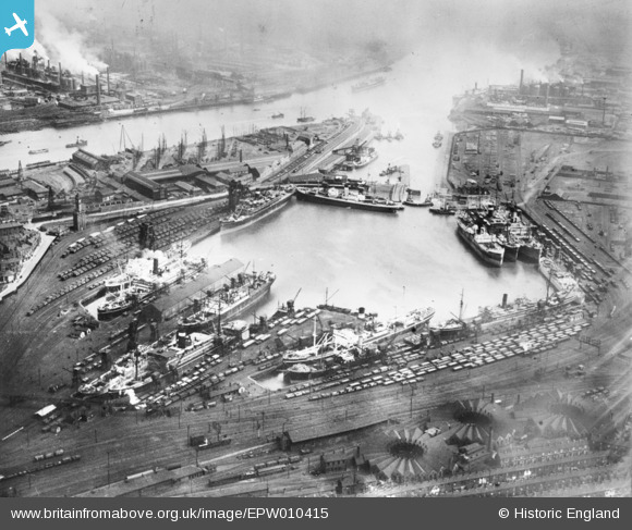
EPW010415 ENGLAND (1924). Middlesbrough Dock, Middlesbrough, 1924. This image has been produced from a copy-negative.
© Copyright OpenStreetMap contributors and licensed by the OpenStreetMap Foundation. 2024. Cartography is licensed as CC BY-SA.
Nearby Images (3)
EPW010415

EAW024124

EAW024125

Details
| Title | [EPW010415] Middlesbrough Dock, Middlesbrough, 1924. This image has been produced from a copy-negative. |
| Reference | EPW010415 |
| Date | April-1924 |
| Link | |
| Place name | MIDDLESBROUGH |
| Parish | |
| District | |
| Country | ENGLAND |
| Easting / Northing | 450305, 520728 |
| Longitude / Latitude | -1.2216398375605, 54.579131204112 |
| National Grid Reference | NZ503207 |
Pins
 J May |
Wednesday 22nd of October 2014 01:11:55 PM |


