
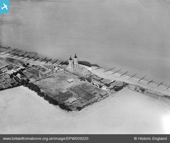
EPW009220 ENGLAND (1923). The Ruins of St Mary's Church, Reculver, 1923
© Copyright OpenStreetMap contributors and licensed by the OpenStreetMap Foundation. 2024. Cartography is licensed as CC BY-SA.
Nearby Images (6)
EPW009220

EPW035489

EPW035490

EPW000531

EPW035487

EPW035488

Details
| Title | [EPW009220] The Ruins of St Mary's Church, Reculver, 1923 |
| Reference | EPW009220 |
| Date | 1923 |
| Link | |
| Place name | RECULVER |
| Parish | |
| District | |
| Country | ENGLAND |
| Easting / Northing | 622775, 169370 |
| Longitude / Latitude | 1.2016372299108, 51.379096978116 |
| National Grid Reference | TR228694 |
Pins
 toriangel |
Thursday 20th of October 2016 05:20:15 PM |


