
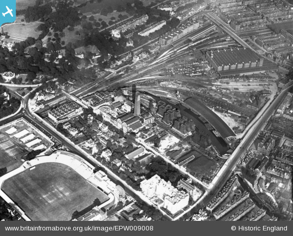
EPW009008 ENGLAND (1923). Power Station on Regents Canal and Lord's Cricket Ground, St John's Wood, 1923. This image has been produced from a print.
© Copyright OpenStreetMap contributors and licensed by the OpenStreetMap Foundation. 2024. Cartography is licensed as CC BY-SA.
Nearby Images (24)
EPW009008

EPW009006

EPW009007

EPW009093

EAW044242

EAW030527
 underway at Lord's Cricket Ground, 1950")
EPW006685

EPW006686

EPW006682

EAW000548

EPW039574

EAW015848

EAW024223

EPW006155

EPW006684

EPW006687

EPW006688

EPW006681

EAW030526
 underway at Lord's Cricket Ground, 1950")
EPW006683

EAW006466

EAW030528
 underway at Lord's Cricket Ground, 1950")
EAW006465

EPW031880

Details
| Title | [EPW009008] Power Station on Regents Canal and Lord's Cricket Ground, St John's Wood, 1923. This image has been produced from a print. |
| Reference | EPW009008 |
| Date | July-1923 |
| Link | |
| Place name | ST JOHN'S WOOD |
| Parish | |
| District | |
| Country | ENGLAND |
| Easting / Northing | 527064, 182569 |
| Longitude / Latitude | -0.16810456428348, 51.527237753638 |
| National Grid Reference | TQ271826 |
Pins
Be the first to add a comment to this image!


