
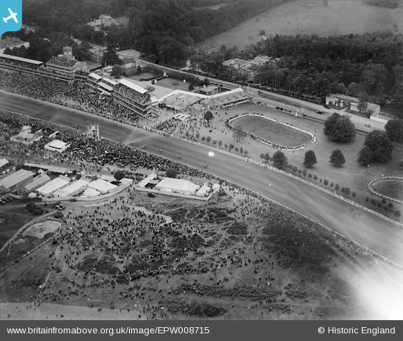
EPW008715 ENGLAND (1923). The Racecourse, Parade Ring and Royal Enclosure, Ascot, 1923
© Copyright OpenStreetMap contributors and licensed by the OpenStreetMap Foundation. 2024. Cartography is licensed as CC BY-SA.
Nearby Images (26)
EPW008715

EPW008716

EPW006706

EPW026284

EPW013441

EAW022116

EPW008705

EPW006704

EPW026285

EPW006708

EPW036160

EPW026290

EPW008709

EAW022115

EPW008704

EPW026288

EPW006700

EPW013401

EAW022114

EAW042137

EAW022117

EPW008707

EPW026283

EPW008710
, Ascot, 1923")
EPW006707

EPW026287

Details
| Title | [EPW008715] The Racecourse, Parade Ring and Royal Enclosure, Ascot, 1923 |
| Reference | EPW008715 |
| Date | 1923 |
| Link | |
| Place name | ASCOT |
| Parish | SUNNINGHILL AND ASCOT |
| District | |
| Country | ENGLAND |
| Easting / Northing | 491809, 168947 |
| Longitude / Latitude | -0.67974606685551, 51.41160857749 |
| National Grid Reference | SU918689 |
Pins
Be the first to add a comment to this image!


