
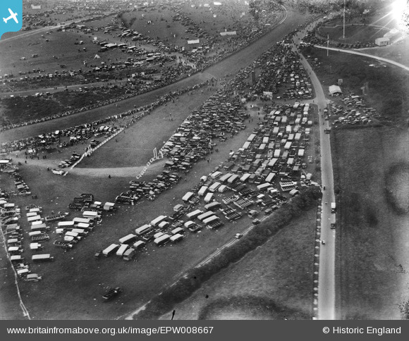
EPW008667 ENGLAND (1923). Tattenham Corner Road, Epsom, 1923
© Copyright OpenStreetMap contributors and licensed by the OpenStreetMap Foundation. 2024. Cartography is licensed as CC BY-SA.
Nearby Images (11)
EPW008667

EPW038136

EAW000994

EAW043434

EAW043435

EAW000999

EPW007655

EPW035513

EPW006447

EPW027521

EAW049846

Details
| Title | [EPW008667] Tattenham Corner Road, Epsom, 1923 |
| Reference | EPW008667 |
| Date | 1923 |
| Link | |
| Place name | EPSOM |
| Parish | |
| District | |
| Country | ENGLAND |
| Easting / Northing | 522473, 157910 |
| Longitude / Latitude | -0.24278078377241, 51.306607876121 |
| National Grid Reference | TQ225579 |
Pins
Be the first to add a comment to this image!


