
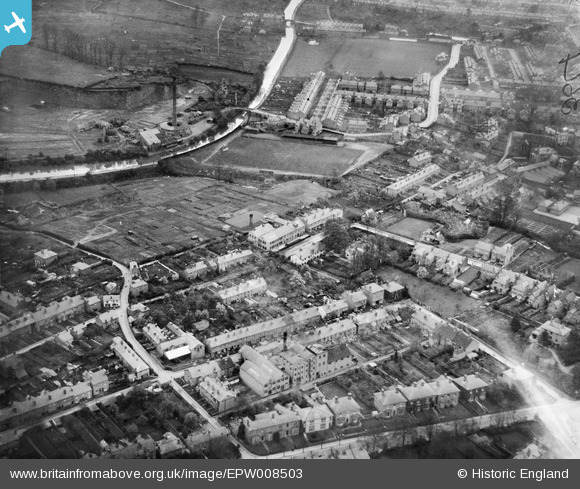
EPW008503 ENGLAND (1923). Raglan Street and environs, Worcester, 1923
© Copyright OpenStreetMap contributors and licensed by the OpenStreetMap Foundation. 2024. Cartography is licensed as CC BY-SA.
Nearby Images (7)
EPW008503

EPW008501

EPW008502

EPW008504

EPW008505

EPW008506

EAW003986

Details
| Title | [EPW008503] Raglan Street and environs, Worcester, 1923 |
| Reference | EPW008503 |
| Date | 1923 |
| Link | |
| Place name | WORCESTER |
| Parish | |
| District | |
| Country | ENGLAND |
| Easting / Northing | 384811, 256494 |
| Longitude / Latitude | -2.2222944962972, 52.20605996936 |
| National Grid Reference | SO848565 |
Pins
 Newnsie567 |
Tuesday 22nd of November 2016 10:03:03 PM | |
Newnsie567 |
Tuesday 22nd of November 2016 10:01:49 PM | |
Newnsie567 |
Tuesday 22nd of November 2016 10:00:56 PM | |
Newnsie567 |
Tuesday 22nd of November 2016 10:00:17 PM | |
Newnsie567 |
Tuesday 22nd of November 2016 09:59:15 PM | |
Newnsie567 |
Tuesday 22nd of November 2016 09:57:59 PM |


