
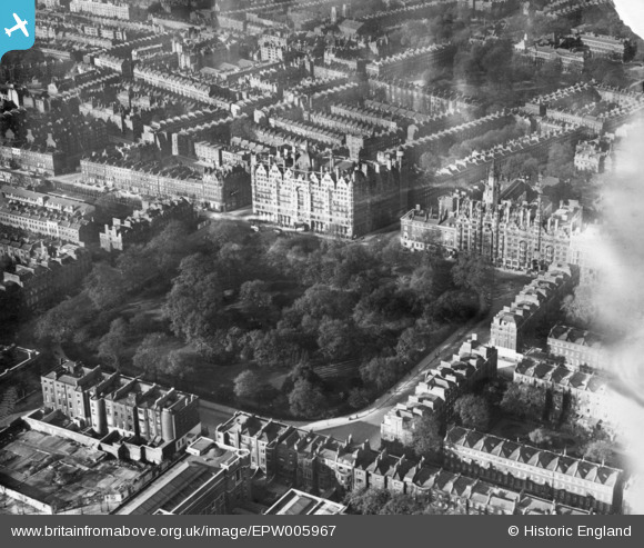
EPW005967 ENGLAND (1921). Russell Square, Bloomsbury, 1921. This image has been produced from a print.
© Copyright OpenStreetMap contributors and licensed by the OpenStreetMap Foundation. 2024. Cartography is licensed as CC BY-SA.
Nearby Images (11)
EPW005967

EAW000657

EAW011086

EPW060554

EPW016653

EPW019025

EPW024279

EPW060553

EPW060555

EPW060557

EPW060556

Details
| Title | [EPW005967] Russell Square, Bloomsbury, 1921. This image has been produced from a print. |
| Reference | EPW005967 |
| Date | 1-May-1921 |
| Link | |
| Place name | BLOOMSBURY |
| Parish | |
| District | |
| Country | ENGLAND |
| Easting / Northing | 530140, 182026 |
| Longitude / Latitude | -0.12398344171928, 51.521656820354 |
| National Grid Reference | TQ301820 |
Pins
 Alan McFaden |
Wednesday 24th of December 2014 07:35:35 PM | |
Alan McFaden |
Thursday 13th of November 2014 11:36:40 AM |


