
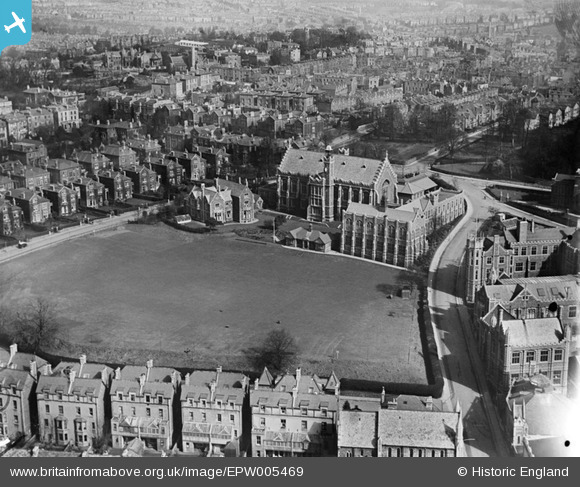
EPW005469 ENGLAND (1921). Bristol Grammar School, Bristol, 1921
© Copyright OpenStreetMap contributors and licensed by the OpenStreetMap Foundation. 2024. Cartography is licensed as CC BY-SA.
Nearby Images (17)
EPW005469

EAW000733

EAW000734

EAW000735

EPW041482

EPW033149

EAW000736

EAW015783

EPW033150

EAW015779

EPW022271

EPW011998

EPW047092

EPW033151

EAW015784

EPW033148

EAW015782

Details
| Title | [EPW005469] Bristol Grammar School, Bristol, 1921 |
| Reference | EPW005469 |
| Date | 20-March-1921 |
| Link | |
| Place name | BRISTOL |
| Parish | |
| District | |
| Country | ENGLAND |
| Easting / Northing | 358058, 173418 |
| Longitude / Latitude | -2.6037423647625, 51.45769592161 |
| National Grid Reference | ST581734 |
Pins
 Brian |
Tuesday 24th of November 2020 12:59:03 PM | |
 Chas Drown |
Friday 29th of June 2012 04:17:30 PM |


