
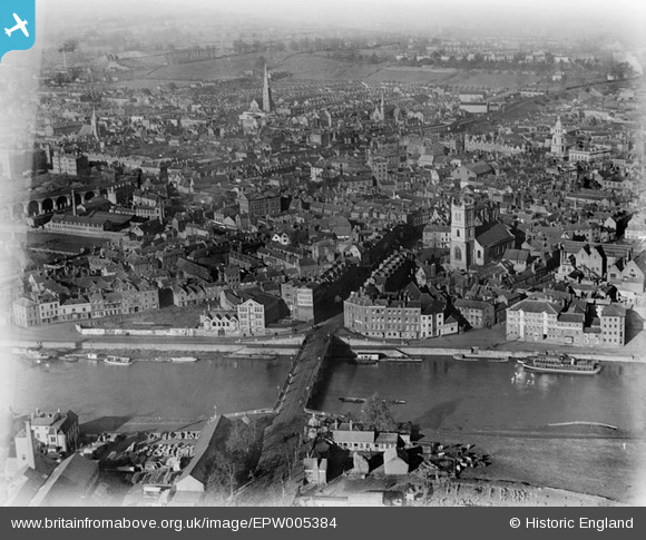
EPW005384 ENGLAND (1921). Bridge Street and environs, Worcester, 1921
© Copyright OpenStreetMap contributors and licensed by the OpenStreetMap Foundation. 2024. Cartography is licensed as CC BY-SA.
Nearby Images (20)
EPW005384

EPW000206

EPW001300

EPW001336

EAW046113

EPW005383

EPW005380

EPW001304

EPW001301

EPW000204

EPW005407

EPW000203

EPW000211

EAW046114

EPW048088

EAW023845

EPW035911

EAW023846

EPW045004

EPW001298

Details
| Title | [EPW005384] Bridge Street and environs, Worcester, 1921 |
| Reference | EPW005384 |
| Date | March-1921 |
| Link | |
| Place name | WORCESTER |
| Parish | |
| District | |
| Country | ENGLAND |
| Easting / Northing | 384722, 254917 |
| Longitude / Latitude | -2.2235258764958, 52.191878121748 |
| National Grid Reference | SO847549 |


